VOLCANO ROULETTE WITH THE GODDESS PELE
A big day planned so we are on the road by 7:05 AM Kona time. We are headed back to the Hawaii Volcanoes National Parks. Two hours, and we are at the park gate. No side trips this time, my sun glasses are safely on my face. We stop in to the visitor centre to register. We will be hiking in the rift zone and should Pele decide to have a bad day they want to know who to send the ashes back to. Personally, I think that would be a great way to go.

Nonie looks a bit apprehensive as she is not ready to be turned into ashes. We decide to go anyway. I did not get enough of a coffee fix due to our early departure so we headed over to the nearby and aptly named Volcano Hotel to find a cup. The hotel has been around in one form or another for over 100 years. Those damn bus tourists! We wandered around looking at the old pictures; many were eruption shots with a row of tourists lined up along the edge of the crater and lava spurting up over 1500 feet in the air in the background. Nonie’s apprehensiveness increases but I get my coffee addiction looked after.
Photo: hilo.hawaii.edu

We missed the trail head on our first try. The road was just starting to give us great views of the massive steam clouds that were being caused by the lava entering the ocean so distracted, we drove by the parking lot. I am an old steam engineer and I always get excited when I see steam. I realized my mistake after a couple of extra miles, so we turned back and found the parking lot. There was already one car in the lot, so someone was a head of us on the trail. We headed out at 10:35 AM Kona time.

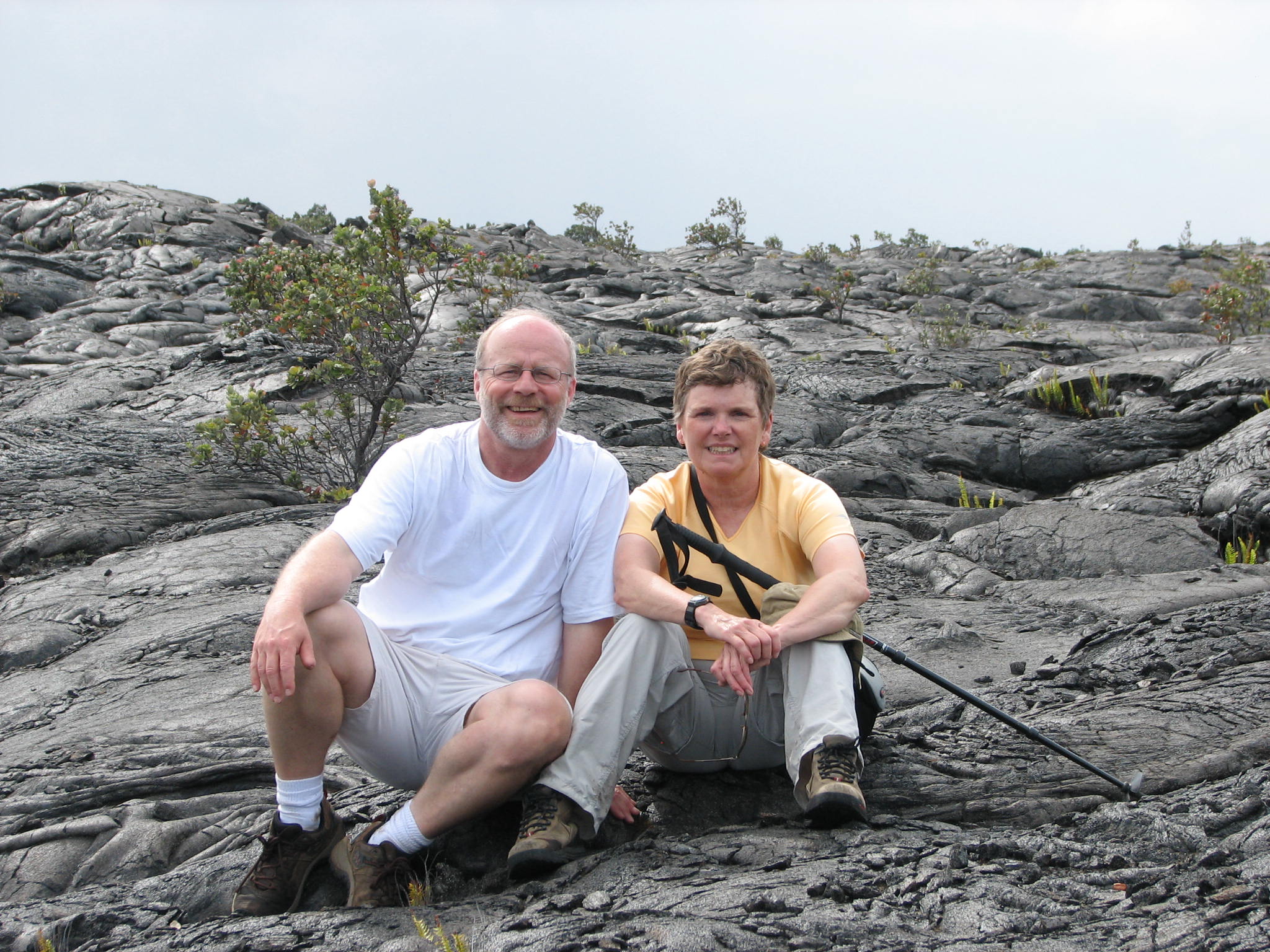
The trail started out over some old a’a’ lava and was a little rough. Hopefully this was not going to be for the entire trail. Walking on this stuff is like walking on ball bearings made of cinder. They are constantly moving under your feet and make it very uncomfortable and very slippery. This is not a place to sprain an ankle. After about a few hundred feet, we moved out on to the pahoehoe lava. This type of lava is much better for hiking. It is flatter, smoother, though you still need to watch your footing carefully. We had our hiking poles and the extra point of contact helps maintain better control of your balance. The lava is very rough and falling on it is not an option.

The weather was starting to close in around us. Lots of thick dark cloud with very gusty wind conditions. It was not raining but the air was so laden with moisture it was like rain. We were starting to get damp so we put on our Valley First ponchos. This will be the first time we have ever needed them despite taking them on numerous hikes. The weather continued to get worse. We were now walking in fog, it was raining and the wind had picked up in intensity. This was all in the first ½ hour of starting the hike. We may be cutting this hike short.

It took as just over an hour to reach the first trail marker at 2.2 miles. In one section of the trail, I spotted a very flat piece of lava which looked almost like pavement. I wandered over to inspect it only to discover that it was a small 3’ by 3’ piece of asphalt. We were hiking on an old road that had been covered by the lava flow.
We met up with the people who were a head of us on the trail. Looked like the weather had got the best of them and they were headed back. I had decided to at least get to the first trail marker before making our minds up about continuing the hike. About two minutes after we met up with the other hikers we left the lava field and entered a small grove of trees.


We reached the second trail marker in about 40 minutes. No crater! The foliage was very thick so I guess the crater was out there somewhere, we just could not see it and I was not about to go crashing around the jungle to find it. The next leg of the hike was just less than 2 miles and would take us to the Napau crater.

If the guide books were correct, we should be able to see the active cinder cone vent of P’u O’o. The trail continued through the rain forest. It became quite narrow and overgrown with very wet ferns and fronds rubbing up against you. After a few hundred feet, our lower extremities were soaking wet. We did come across a marked and cleared trail to a lookout over the Napau crater. HOHUM! Having seen one crater, you have seen them all.
This part of the trail was reasonably flat, so we were able to make good time. We came to a fork. Left would take us to a campsite and the continuation of the trail to the P’u O’o vent. The cinder cone is closed and off limits and there is danger from the VOG. VOG is volcanic smog and can be very nasty to your health. The right fork would take us to the supposed view point. Nonie the intrepid jungle explorer took the lead and the left trail. I told her not to fall off the crater rim if she found it. Not more than five minutes in and she shouted “I found it” followed by a “WOW!” The hike had been worth it.

The cloud had lifted high enough so we were gifted with a view of the cinder cone. The view was partially obscured by gas and steam rising from the walls of the vent facing us. The cinder cone had collapsed on our side and had opened all kinds of cracks which were venting steam and VOG. This vent has been erupting since 1983. Most of the lava now flows out the vent through a lava tube and travels almost 7 miles to the ocean before it appears again.
We settled down on a log and broke open the lunch we had brought and watched planes and helicopters flit in and out of the vent. This made our impending helicopter flight even more exciting to see where we be going the next day. Every once in a while the wind would below the steam away and we would get cleaner views of the cinder cone. Very nice lunch!
We headed back after about ½ hour. We would return on the same trail. The forest had dried quite a bit so it was not such a slimy return trip. Nonie and I both agreed that hiking on even the roughest lava was better then the boring monotony of a trail through the rain forest. I am sure that if we had someone along who could show us some of the things that we were missing or not understanding, it might make the trip more interesting.
As we walked across the upper portion of the lava field, we
entered a zone of VOG. Not real thick
but thick enough to see the brown colour in the air. There was a faint smell of
sulfur and grabbing feeling at the back of my throat. It is a smell that I am
familiar with as I experienced it often during my
A short rest in the comfort of a small covered picnic area located at the trail head, two vitamin Ibuprofen and some Gatorade and we were ready to move on.

We continued the drive down the Chain of Craters road. The road suddenly ends in the lava field that was and continues to be created by the P’u O’o vent. Our intent was to walk into the lava field and out to a view point that over looked the area where the lava was exiting the lava tube and pouring out into the ocean. We were walking on a part of the island that had only been created about 25 years before when the vent first erupted. Once there we would settle in and wait till the sun went down. The glow of the lava cannot be seen during the day as the sun washes out the colour. The hot lava actually looks silver when you see it from the air.

We arrived at the end of the road to find that the park folk have created a turn around and you are only allowed to park on the outgoing side of the road. It was not particularly busy so we did not have to come back more than a couple of hundred feet to find a parking spot. We then had a ½ mile walk along the road to reach the lava field and a short hike over the lava field to find ourselves a beautiful vantage point to watch the lava flows.
We still had a bit of food left from our lunch and we had brought books to read so we settled in to wait for the sun to set. We were able to view the area with our binoculars and as the sun slipped lower into the east, the lava become much more visible and it now could even be seen with the naked eye. People started to arrive in droves and suddenly our little slice of the viewing area got a lot smaller with rude people starting to set them selves up in front of us. Damn Tourists!

The darker it got, the brighter the lava became. You could now see it flowing down the side of the sea cliffs in long thin strands. You could see lava falling in the ocean and exploding in to steam. Red hot spots began to show up along the edge of the cliff. Very cool! I made a number of attempts to take pictures, but I do not think that I was very successful so I will have to fudge some up from the internet.
Returning to the road over the lava field in the dark was a tricky maneuver even with head lamps. The park had installed little reflective markers that you could use to guide you back to the road. The markers were not always placed in the best spot but it would have been very difficult to find our way back with out them. Even with a good headlamp, it was a challenge not to fall. People have been known to try and travel out over the lava field onto the active field for a real close up look at of the lava at night. Better to travel at night as you can spot the hot stuff before you step in it. Nonie and I are not that crazy. I really wanted to get a picture of me poking a stick into a slow moving lava flow but I think will opt to live a little longer. It would not be like stepping into some dog pooh that you could scrape it off with your stick.

We hit the road for

Uncle Billy’s is right out of the fifties with fake rattan furniture, lots of grass covered lamps and bamboo wall paper on everything. Johnny Weissmuller would have been at home here. The room was rough around the edges but reasonably clean and sadly the Mai Tai wasn’t as good as the Kailua Kona one.
Photo: SAH Archipedia
No comments:
Post a Comment