The morning of Day 9
was the start our longest drive of the trip, just over 350 kilometres. The
rain had moved on and a sunny day was in the forecast. Our route would take us
from south end of the North Island up into its central plateau. Vistas here,
were very different than those of the South Island. Brilliant green hills and
fields as far as the eye can see. The trip
was made longer by a few more surprise road closures that sent the GPS into
fits of “recalculating”.
We are headed for Tongariro National Park, home to three active
volcanoes. Mount Tongariro, Mount Ruapehu
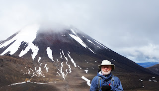
and Mount Ngauruhoe. Mount Ngauruhoe is the youngest of the three volcanoes,
about 2500 years old. We have traveled the
world and have never missed the opportunity to climb up and/or into volcanoes.
Hawaii, St. Lucia, Easter Island, Chile, Argentina, Mongolia, Italy, Canada.
Mount Ngauruhoe is kind of special.
Mount Ngauruhoe is kind of special.
It is also well known as Mount Doom, the fictional volcano of Middle-Earth, where the ring was first
forged and the destination of Frodo’s quest. The park was used as a location for both the Lord of the Rings and The Hobbit.
We were here to attempt the Tongariro Crossing, a hike that
would have us follow in the footsteps of Frodo in his quest to destroy the ring
by throwing it the caldera of Mount Doom.
In long shots in the movie, the mountain is either a large
model or a CGI effect or a combination. Filming at the summit of Ngauruhoe
itself was not permitted because it is sacred to the Maori of the region. Some scenes on the slopes of Mount Doom were actually filmed on the slopes
of Mount Ruapehu.
Day 10 had us waking up to a mixed bag of a day with a weather forecast of "cloudy and periods of rain".
Temperature was around 2 C. Not the best weather for a quest but not the worst so it was up
and outside for a 6:30 am shuttle pickup that would take us to the
trail head. The trail would have us climb 19.4 kilometres up into a high valley between Mount Tongariro and Mount Ngauruhoe, crossing two large craters with a rapid descent into a mountain forest and trails end.
The trek is very popular, we discovered as we were joined by a hundred or so others at the trail head. According
to our shuttle driver, this was just the start of the hiking season and the
trail would be 20 times busier as the weather warmed up.
The hike starts as a gentle gradient climbing beside a small stream and along the edges of old lava flows. At the head of the valley you can access Soda Springs and the area is quite boggy.
The hike starts as a gentle gradient climbing beside a small stream and along the edges of old lava flows. At the head of the valley you can access Soda Springs and the area is quite boggy.
From Soda Springs, the track climbs steadily bringing us to the lip of the South Crater and a view of Yellow Lake. South Crater is not a real crater but a basin that may have been glacially carved, and has since filled with sediment from the surrounding ridges.
Down into, across and a steep climb out of the crater,
along a rocky ridge,
brought us to a view of the highest point of the Crossing, at 1866 metres,
and some snow.
From here, there was a tricky little descent into the South Crater and the Emerald Lakes. If
it had been clear, you would be able to see across the Central Crater to Blue Lake where we
planned to stop for lunch.
The Emerald Lakes are thermal. As we got closer you could see steam venting from cracks around the lake.
After a short steep, snowy climb out of the Central Crater we arrived at Blue Lake barely visible through the fog and rain that had settle over us.
We decided to keep moving and have lunch once the
rain had stopped. It was fortuitous as it seems that the Blue Lake is tapu
(sacred) and you are asked not to swim or eat food around the lake.
From Blue Lake the trail starts to descend through golden tussock
covered slopes.
The tussock was made up of delicate grasses, plants, colorful lichen and small flowers. Very beautiful and delicate.
The fog and rain
seemed to follow us along the trail as we descended into a hardwood forest and
the pick-up point for our shuttle back to the hostel.
We completed the hike in 6 hours and 15 minutes. We had been
talking to another couple (about our age) the night before at the hostel and they mentioned that they had done the hike in 7 hours. They seemed a bit smug about it, so we
were determined to come back with a much better time than they did. You may notice we look a little smug.
We leave tomorrow for the hot springs that abound around
Lake Taupo.


No comments:
Post a Comment